 |

1. Geographic Conditions
Laoag City is bounded by five municipalities;
Sarrat in the east; San Nicolas in the southeast; Paoay in the southwest; Vintar in
the northeast; Bacarra in the northwest and finally the China Sea in the west.
Laog City can be reached by both land and air
transportation from any origin.
2. Land Features
2.1 Land Area
Laoag city has a total land area of 12,747.35
hectares or 127.4735 square kilometers. It is consists of 80 barangays of which 30
are Urban and 50 are rural barangays.
Of the total land area, 980.847 h. is
occupied by the urban core or the poblacion while 11,816.501 is occupied by the rural
barangay.
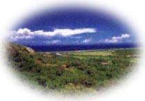
2.2 Topography
The central part of the city is predominantly
lowland, with a sloping terrain of five to ten feet above sea level going west. from the
northeastern part of the city going west to Dianalare virgin hills diminishing in height
from 52 feet to 10 feet above sea level.
In North-eastern part of the city are hills and
mountains. The highest among the peaks is 183 foot above sea level. These hills are
forested area.
2.3 Geology
Laoag city has a rugged terrain and irregular
outline. The southwestern portion which is part of physiographic unit known as the
Ilocos Coast Strip, consists largely of elevated coastal tract, mainly alluvium overlaying
older sediments with some portions of raised coral. The plain is bounded at the east by an
escarpment which is partly due to a fault and party to andesitic extrusive.The hills along
the rolling area above the coastal plans are tertiary and sedimentary rocks such as
limestone, sandstone, conglomerates and limy shales.
The situation of faulting in the study area is
influenced in the Luzon Central Cordillera which could be just a case of scissoring along
the fault zone or it could mark a rhombohedral split between echelon segments of
Dingalen-Lingayen segment connected similarly with Bangui Fault.
The Bangui Fault slices in a NW-SE direction on
the Northern part of the Luzon Central cordillera from Bangui Bay and extends southward to
mark the boundary between the Cordillera and Cagayan basin.
Historical data on the occurence of earthquake
in the study area pointed out two damaging earthquakes. The most devastating was on 17
August 1983 at 8:13 in the evening wherein a number of reinforced concrete buildings
either totally collapsed or sustained major structural damage beyond rehabilitation.
2.4 Land Use Classification
The general framework for land utilization,
having spatial and vocational dimensions, is an essential element in planning future
developments of an area. The various factors used in drawing up an optimal land use
for Laoag city include geology and soils, climate, slope, erodability, existing projects,
infrastructure and settlement, national policies on wildlife conservation and
other institutional constraints.
3. Climatic Condition
Type (coronas) climate prevails in Laoag City.
This is characterized by two pronounced seasons, i.e. dry from November to April and wet
the rest of the years.
The average annual temperature of the city is
27.25 degrees centigrade with a relative humidity of 75.55%.
The area shielded from the Northern winds and
to some extent from the Pacific tradewinds by the Cordillera and Sierra Madre Mountains,
respectively. However, tropical cyclones and storms visit the region because of its
vulnerability to the Southwest monsoon (PAG-ASA Report).
|
|